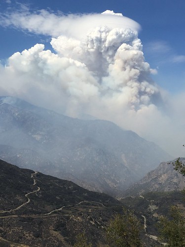
Smoke from wildfires can have an enormous impact on the public and on fire personnel, affecting health, interfering with transportation safety and upsetting tourism and local economies.
Trent Procter, like all U.S. Forest Service Air Resource Advisors, is a technical specialist with expertise in air quality science, including: air quality monitoring, smoke modeling, pollutant health thresholds and communicating about smoke risks and mitigation.
“Smoke from wildland fire is a significant source of air pollution. It can pose potential risks to health, visibility, safety and general nuisance problems. Forest managers, fire managers and air resource specialists must address these issues when and where appropriate to minimize smoke impacts to public health and welfare,” he explained.
Exposure to smoke is a concern because a large proportion of wildland fire smoke emissions are fine particulate matter that can penetrate to the deepest parts of the lungs.
Air Resource Advisors can be dispatched to an incident to assist with understanding and predicting smoke impacts on the public and on fire personnel. Whenever smoke is a concern, their objective is to provide timely smoke impact and forecast information and messages based on best-available science.
Technology plays a big part in this forecasting process.
“Satellite images, monitoring data and smoke modeling projections all inform the typical smoke forecast,” Procter explained.
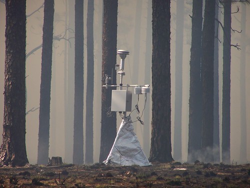
The Forest Service works with partner agencies to deploy “real time” monitoring http://app.airsis.com/usfs/fleet.aspx into communities and locations where instant feedback is helpful in keeping the public and health officials informed. The monitors transmit the smoke concentrations to satellites and then back to web-based tools that help provide the smoke concentrations seen in the forecasts.
Air Resource Advisors work with multiple agencies to address public health concerns, smoke risk to transportation safety and fire personnel exposure, as well as how to reduce and mitigate smoke exposure.
As the Pacific Southwest Region’s Air Quality Manager, Procter’s work takes him throughout the state, and during this year’s drought-fueled wildfire season, he’s been busy coordinating with other agencies for appropriate response to smoke.
“The success in bringing helpful information to the public in California is a credit to our partners at the air pollution control districts and the California Air Resources Board. The staffs in these agencies are professional and so very dedicated to an emergency response that helps the public reduce or manage their exposure,” he said.
Before igniting a prescribed fire - a fire being used for specific land management objectives - managers must identify smoke-sensitive areas such as communities, hospitals and highways and use appropriate mitigation and evaluation techniques to minimize smoke impacts. Weather, climate and air quality monitoring data are used by fire managers to customize smoke management techniques as needed in these cases.
"In the case of wildfires, where managers have little or no control over what burns, many times it’s a matter of understanding fire behavior, fuel combustion and suppression techniques,” Procter explained.
“That enables us to understand how those features and management actions will play out with weather forecasts and subsequently allow a credible forecast of where smoke will go -- or sometimes, more importantly, where it won’t go. Our recent efforts to improve wildfire smoke forecasting are allowing us to learn much that can improve our smoke management techniques in prescribed fire projects.”

