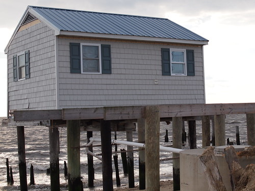
About two years ago, Hurricane Sandy wreaked havoc on several states in the Northeast, causing $68 billion dollars’ worth of damage to critical infrastructure, businesses, homes and landscapes. Since 2012, multiple agencies, including the USDA’s Natural Resources Conservation Service (NRCS), have remained committed to helping the region build back stronger and better prepared for future storms.
To help the victims recover from Sandy and prevent future devastation in vulnerable flood areas, NRCS has invested about $120 million in Emergency Watershed Floodplain Easement Program, a program that helps restore and protect lands vulnerable to flooding.
“This program will ensure long-term stability and help relieve the stress these landowners have been enduring for more than two years now,” said Andrew James, the program’s manager.
The easement program complements traditional disaster recovery funding and allows NRCS to purchase a permanent easement on lands within floodplains that sustained damage from Sandy. Through the program, easements were placed on more than 1,000 acres in Connecticut, New Jersey and New York.
Restoration of floodplains improves the natural functions of the plain while establishing the flow of water back into the area. It protects properties downstream, and it enhances fish and wildlife habitat. It also improves water quality and ground water recharge.
Here are a few examples of how this easement program is working:
West Haven, New Haven County, Connecticut: The neighborhoods near Beach Street were hit especially hard as homes were irreparably damaged and families had to be evacuated. NRCS will provide more than $7 million for the restoration and permanent protection of 31 properties, 15 funded through the first sign-up and 16 funded through the second sign-up. These properties cover 71 acres of vulnerable floodplain lands, including 11 acres of residential lots. Floodplain restoration and removal of structures will benefit both landowners and the surrounding community.
Cumberland County, New Jersey: The Cumberland County application is the largest submitted to NRCS during the Hurricane Sandy recovery effort, consisting of more than 450 acres of marshy, flood prone property currently used to produce salt hay. The southern end of the area is adjacent to a large tract of state-owned open space land and the northern end is by a large NRCS wetlands easement. By linking these two properties together, the Cumberland County application serves to greatly increase the footprint of protected land in the area. This will allow for comprehensive restoration of the properties’ floodplain functions and values.
Mastic/Shirley Area, Suffolk County, New York: Numerous small parcels of land, some with houses, located in this low-lying, 100-year floodplain on Long Island were severely impacted by Hurricane Sandy. NRCS’ investment of about $5.6 million on 45 acres will provide permanent protection and will provide a critical buffer to a densely developed residential area to the north of the enrolled lands. The Mastic/Shirley area is adjacent to the natural shoreline of the William Floyd Estate, a significant environmental area of 600 acres to the east owned by the U.S National Park Service and part of the Fire Island National Seashore.
These easements will be complete in the coming months, providing places for floodwaters to go during times of heavy rains and other natural disasters like Sandy.
“Just like we work with farmers to invest in the health of their soil, which will lead to bigger harvest down the road – this program enables us to work with landowners to help prevent damage from flooding in the future,” James said.

